Key Takeaways
- Real-time vehicle locations, an interactive fleet map, and trip history are the three things a GPS platform must deliver before anything else matters.
- Automatic driver identification using RFID or Dallas ID technology ties every trip record and fuel figure to the correct driver, not just the vehicle.
- Driver behavior monitoring covers harsh braking, rapid acceleration, and sudden direction changes, each recorded with a map location so coaching conversations are based on facts, not estimates.
- Fuel consumption monitoring combined with purchase records in the same platform is how fleets catch waste and spot potential theft without running a manual audit.
- Geofencing with custom points of interest sends automatic alerts by email or phone when vehicles cross boundaries you define, with no manual map-checking required.
- API connectivity to ERP, HR, and other business systems means your fleet data moves where it needs to go without someone re-entering it by hand.
- Hardware selection is where most GPS buying decisions go wrong. The right device depends on whether the asset has continuous power, needs non-invasive installation, or sits unattached for weeks at a time.
- When GPS tracking is built into your ELD platform rather than added through a separate system, your HOS records and location data sit together from the start.
| Table of Contents |
|---|
| Platform Fit |
| Real-Time Tracking |
| Driver and Behavior |
| Geofencing and Alerts |
| Reporting and API |
| Hardware Selection |
| Feature Comparison |
| Buyer Questions |
| FAQs |
Introduction
Choosing a GPS tracking platform is straightforward when you know which features your operation actually needs. The purchases that go wrong almost always come down to the same three issues: hardware that does not fit every asset type, reporting that cannot reach the back office, and behavior data that tells you what happened but not who was responsible.
The right GPS platform does not just track vehicles. It gets the right data to the right people in a format they can actually use. When that does not happen, fleets end up paying for a system they work around rather than one they rely on.
Here is what we cover in this guide, in the order it matters during an evaluation, including where GPS and ELD data can work together if your fleet runs under FMCSA requirements. If you would rather talk through your situation before reading the full breakdown, you can schedule a call with our team or reach us at (800) 261-4361.
Why Does Platform Fit Matter More Than Feature Count?
Buying a GPS platform with more features than your operation needs is a waste of money. Buying one that is missing the features your operation depends on is a bigger issue. The fleet managers who end up dissatisfied 6 months after a purchase almost always chose based on price or interface rather than asking whether the platform actually solves what their fleet faces day to day.
The most common gaps we hear about are reporting that looks good in a demo but cannot export in a format the accounting team can use, driver behavior data attached to a vehicle number rather than a named driver, hardware ordered for a mixed fleet where trailers end up with trackers that lose power the moment they are unhooked from a truck, and alert systems sending emails to inboxes that nobody monitors from a cab. None of these are hardware or software failures. They are fit failures, and they are avoidable if you know what to ask before you commit.
For fleets running box trucks, the fit question also includes whether your vehicles fall under the ELD mandate. Our box truck ELD guide covers which vehicles require electronic logging and which do not, which affects whether you need GPS-only hardware or a combined ELD-GPS setup for part of your fleet.
What Does Real-Time Tracking Actually Give Your Fleet?
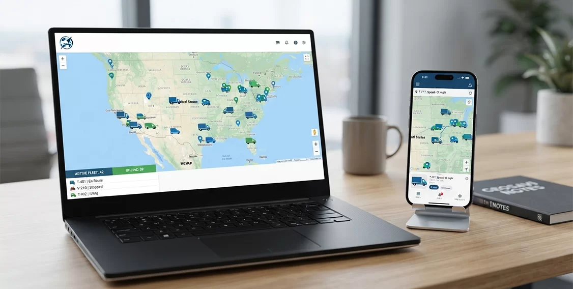
Many fleet managers are dispatching vehicles without a live view of where those vehicles actually are, relying on driver phone calls that pull attention in two directions at once. A live map showing current vehicle positions, alongside a vehicle list you can click into for each truck’s status and recent trip path, removes that phone call from the equation entirely. You see where every vehicle is, where it has been, and whether it is moving or parked, without interrupting anyone.
Update intervals vary across GPS tracking vendors, and that variation matters more than most demos suggest. Ask any vendor you evaluate for their specific update interval and confirm whether that rate changes when a vehicle is stationary, because the answer directly affects how useful the live map is for time-sensitive dispatch decisions.
Trip history is the part of real-time tracking that pays off most in daily operations. When a driver arrives late to a job and the customer disputes the timeline, the trip record shows exactly when the vehicle arrived, how long it stopped, and when it left, without anyone needing to reconstruct the route from memory. When fuel spend rises and you cannot explain why, the trip records show mileage by vehicle and by driver, which is where the investigation starts.
Our GPS tracking platform gives you real-time vehicle locations on an interactive fleet map, a selectable vehicle list, and complete vehicle and trip history, all from the same interface, so you are not toggling between a live view and a separate reporting section every time you need both.
How Do Driver Identification and Behavior Monitoring Turn Data Into Accountability?
A GPS that shows which vehicle had harsh braking events this week but not who was driving it turns a safety conversation into a group meeting where the responsible driver may not even know the discussion is about them. Automatic driver identification using RFID or Dallas ID technology fixes this by tying every trip to the correct driver at the moment they take the wheel, without requiring a manual login or a name selected from a dropdown. From that point forward, every trip record, every fuel figure, and every behavior event is attached to a named person rather than a vehicle number.
What Does the Behavior Data Actually Show?
Our platform monitors harsh braking, rapid acceleration, and sudden changes in direction. Each event is recorded with a map location, which is what makes the data usable for coaching rather than just reportable. Knowing a driver had repeated harsh braking events is a starting point, but knowing those events happened at specific intersections, and that the same intersections appear in the driver’s records from the previous month, is a pattern you can act on.
Showing a driver the map of their events during a coaching conversation changes the dynamic of that discussion. The driver can see the location, confirm it, and either explain the road conditions or acknowledge the habit. That specificity makes coaching productive rather than confrontational, and it creates a documented record if the pattern does not improve. Our platform delivers clear, detailed reports of driving style with map records included, so that record exists without anyone having to compile it manually.
How Does Behavior Monitoring Connect to Fuel Costs?
Fuel consumption monitoring gives fleet managers visibility into operating costs across the fleet. Combining those consumption figures with fuel purchase records in the same platform makes discrepancies visible without a manual audit: a purchase that does not match any recorded route, or a vehicle that shows low mileage but high fuel spend. Aggressive acceleration burns more fuel per mile than gradual speed-building, which means behavior data and fuel data are connected. A driver with consistently high fuel spend per mile often shows the same pattern in their acceleration events, and both data points live in the same platform so the investigation takes minutes rather than a cross-reference across two systems.
For fleets focused on the connection between driver behavior and road safety outcomes, our article on how ELDs promote safer roads covers how fleet data tools connect to broader safety patterns across commercial trucking.
What Should Geofencing and Alerts Actually Do for Your Operation?
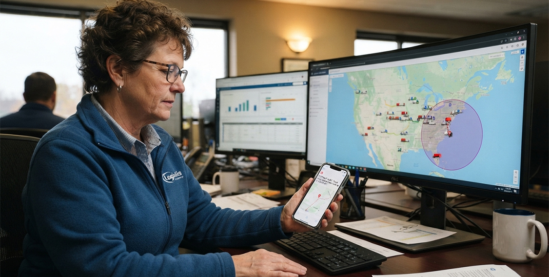
You cannot monitor the live map all day, and you should not have to. A geofence is a virtual boundary you draw around any location that matters to your operation: a customer site, a job site, the yard, a warehouse, an office, or a zone where vehicles should not be. When a vehicle crosses that line, the platform sends an alert by email or phone, immediately and automatically, to whoever you designate.
The practical range of applications is broader than it first appears. A geofence around a customer location confirms arrival and departure times without requiring the driver to log a check-in. A geofence around your yard tells you when a vehicle leaves outside of scheduled hours. A geofence around a restricted zone creates a timestamped record of whether your vehicles stayed clear of it. None of these require you to watch the map because they happen automatically and come to you. Our platform also lets you set alerts based on vehicle mileage, maintenance schedules, dates, and specific map positions, so the notification reaches you before a situation becomes a cost.
How Do Custom Points of Interest Change Your Reports?
Without custom points of interest, trip reports show your vehicles stopping at GPS coordinates. With labeled POIs you define yourself, those same stops read as Customer Warehouse or Morning Fuel Stop, labeled exactly the way your team refers to those locations in daily operations. That label makes reports readable by any member of your team without anyone needing to look up locations or cross-reference a map. Dispatchers, billing staff, and back-office teams can read the reports directly, which reduces the number of people who have to be involved in interpreting fleet data.
We let you create custom POIs and geofences for any location in your operation, with alerts delivered by email or phone based on the event type and the boundary you define. For fleets that need location records connected to their driver inspection documentation, our article on ELD and DVIR integration covers how those two workflows connect when the data lives in the same platform.
How Should Reporting and API Integration Work Across Your Back Office?
Fleet data that lives in the GPS platform while your accounting team works in a separate system, your HR records are somewhere else, and someone is exporting spreadsheets and re-entering figures by hand every week is not helping anyone. A platform with preset reports formatted for authority and regulatory requirements, combined with user-generated reports you build with your own parameters, covers the daily and periodic reporting your operation needs without manual assembly. Multiple export formats mean the records your accounting or compliance team needs move into their system without re-entry.
The API layer is what removes the manual step entirely. When your GPS platform connects to your ERP, HR system, or other business applications through a documented API, fleet data flows automatically. Driver performance data goes into HR files. Trip records go into customer billing. Fuel cost data goes into cost accounting. The export-and-import cycle that consumes back-office time each week disappears when the systems talk to each other directly. Our platform supports API integration for ERP, HR, GPS tracking fleet management, and other third-party applications, with advanced user-generated reports and preset reports for authorities included.
When evaluating any vendor’s API, ask three specific questions: Is it documented publicly so your team can work with it without a paid engagement? Does the vendor have pre-built connectors for the systems you already run? Is API access included in the standard subscription, or does it require an additional tier? That tells you whether the integration will actually work for your operation or whether it exists only on paper.
For fleets thinking about total platform cost relative to the time it saves your back office, our price calculator gives you a clear starting point before any vendor conversation.
Which GPS Hardware Is Right for Each Vehicle and Asset Type?
Most buyers walk out of a GPS platform demo with a clear picture of the software and almost no information about the hardware, which is where the purchase goes wrong, because the device that works perfectly on a company truck is the wrong choice for a trailer that sits unattached in a yard for weeks. Choosing the right tracker for each asset type means your coverage does not have gaps precisely when you need it most: when a trailer is sitting somewhere you did not send it, or when a leased vehicle needs tracking without a permanent installation.
Hardwired 4G LTE Vehicle Tracker
The Teltonika FMM13A is a hardwired 4G LTE GPS vehicle tracker built for powered vehicles in regular service, with ignition detection, BLE connectivity, and advanced vehicle monitoring capabilities. It connects directly to the vehicle’s power system so it stays active as long as the vehicle has power, with no internal battery to manage. Ignition detection tells the platform when the vehicle starts and stops, which is how accurate trip records and idle time figures are generated. This is the right choice for owned trucks and any powered vehicle where a permanent installation is practical.
OBD II Plug-and-Play Tracker
The Teltonika FMM00A is a 4G LTE OBD II plug-and-play GPS vehicle tracker with CAN bus data reading for real-time tracking and fleet management. It plugs into the OBD II diagnostic port and provides vehicle data including ignition status, VIN, odometer, fuel level, and other supported vehicle information depending on the make and model. Installation takes under a minute, requires no tools and no wiring, and works on any vehicle with an OBD II port. For leased vehicles where hardwired installation is not permitted, or for fleets deploying quickly across a large mixed vehicle group, this is the practical path to visibility without the installation overhead.
Battery-Powered Asset Tracker
The Teltonika TAT140 is a versatile 4G LTE GPS asset tracker for trailers, equipment, containers, and other powered or non-powered assets, with internal battery operation, external power capability, and Bluetooth connectivity. When a trailer is dropped at a customer site or parked in a yard, it continues transmitting its location independently of any truck. This is the device that covers the where-is-my-trailer question that vehicle trackers cannot answer, because a vehicle tracker on a trailer loses power the moment the trailer is unhooked.
Solar-Powered Asset Tracker
The SunTech ST4955 is a solar-powered 4G LTE GPS asset tracker for trailers, containers, equipment, and other mobile assets, designed to provide long-term location monitoring with reduced dependence on external power. Solar charging keeps the internal battery maintained from ambient light, which removes the need to manage a battery swap program for assets that may sit for weeks at a time. This is the right choice for any asset where tracking value is highest when the asset has been sitting longest and may be in an unknown location.
You can review all current hardware options and availability in our shop. For local drivers whose vehicles may not require an ELD, our local drivers ELD guide explains which vehicles fall under which rules, relevant if your fleet includes a mix of short-haul and long-haul operations.
How Do GPS Tracking Features Compare Across What Fleets Actually Need?
| Feature | What Goes Wrong Without It | What to Look For |
|---|---|---|
| Real-time tracking | Dispatch decisions made on driver self-reporting rather than live data | Live map with vehicle list and complete trip history in one interface |
| Driver identification | Behavior and fuel data tied to a vehicle number, not a named person | Automatic RFID or Dallas ID with no manual step required from the driver |
| Behavior monitoring | Incidents documented without enough context for a useful coaching conversation | Events logged with map location and clear, detailed driving style reports |
| Fuel monitoring | No visibility into rising fuel spend or potential unauthorized use | Consumption data combined with purchase records in the same platform |
| Geofencing | Manually checking the map to confirm vehicles went where they should | Automatic alerts by email or phone when vehicles cross defined boundaries |
| Custom POIs | Trip reports full of coordinates no one on the team can read quickly | Named location labels applied automatically across all reports |
| Alerts by trigger | Learning about a maintenance overdue or mileage threshold after the fact | Configurable alerts on mileage, maintenance schedule, date, and map position |
| Reporting | Data in the platform that cannot reach accounting, HR, or compliance teams | Preset authority reports, user-built reports, multiple export formats |
| API integration | Back-office staff re-entering fleet data into separate business systems | Documented API with connectors for ERP, HR, and third-party applications |
| Hardware variety | One tracker type leaving trailers, leased vehicles, or assets without coverage | Hardwired, OBD II, battery-powered, and solar options within one platform |
| ELD integration | GPS and HOS records in two systems requiring manual reconciliation | GPS built into the ELD platform so both data sets are in one place |
What Should You Ask a GPS Vendor Before You Sign Anything?
What is the exact location update interval?
Ask for a specific number, not a description. Update intervals vary across GPS tracking vendors, and the difference matters for dispatch decisions based on vehicle proximity. Also ask whether that interval changes when a vehicle is stationary, because some platforms slow their update rate for parked vehicles, which means the position you see may reflect where the vehicle was several minutes ago rather than where it is now.
Is driver identification automatic or does it require a manual step?
Automatic driver identification using RFID or Dallas ID technology associates each trip with the correct driver without the driver taking any action beyond getting in the vehicle. A system that requires a driver to select their name from a list or enter a code before each trip creates a step that gets skipped during busy shifts, which means the behavior and fuel data for those trips cannot be tied to anyone.
Does behavior event data come with a map record attached?
Ask the vendor to show you what a behavior event looks like when you click into it, not the summary dashboard, but the individual event record. If it shows the event type, the time, the driver, and the location on a map, it is a coaching tool. If it shows only a count or a score, it tells you something happened without giving you enough to act on it.
What triggers can you set for alerts, and how are they delivered?
A capable platform lets you set alerts based on vehicle mileage, maintenance schedules, dates, locations, and geofence activity, and delivers them by email or mobile notification. Confirm which triggers are supported, whether alerts are configurable per vehicle or per zone, and whether the delivery method matches how your team actually works, because an alert that goes to an email inbox nobody monitors from a cab is not a useful alert.
What export formats are available, and how far back does history go?
The export format question tells you whether your accounting, HR, and compliance teams can actually use the data without re-entering it manually. Ask which formats are supported, whether API access is included in the standard subscription, and how far back trip and event history is retained. If your fleet has FMCSA record retention requirements or state-level audit obligations, confirm the platform’s retention window covers your compliance period.
Does the platform support all your asset types within one account?
A platform that tracks trucks but not trailers, or powered vehicles but not non-powered assets, leaves gaps in your coverage. Confirm that hardwired, OBD II, battery-powered, and solar-powered trackers all work within the same platform and the same account, with reporting and alerts available for every asset type from the same interface.
How deep is the ELD integration?
Vendors use the word integrated to cover a wide range of actual setups. Ask whether GPS and ELD data live in the same interface, whether you need separate logins, and whether location data appears inside the HOS log record or only in a separate GPS section. Our ELD platform includes built-in GPS tracking, which means both data sets are in one place from the start, not connected through a third-party link. If your fleet includes vehicles that need compliance documentation connecting location to inspection records, our article on ELD and DVIR integration covers how that workflow connects.
What support is available after installation?
Ask whether technical support is available 24 hours a day, 7 days a week, and whether it covers hardware issues alongside software questions. A tracker that goes offline on a Sunday night is not a ticket that can wait until Monday morning for a fleet running time-sensitive operations. Our support team is available around the clock for both hardware and platform questions, included with your subscription.
GPS Fleet Tracking: Your Questions Answered
GPS Tracking Basics
What is the difference between a GPS tracking device and a GPS tracking platform?
The device is the hardware that collects and transmits location data from the vehicle or asset. The platform is the software that receives, stores, and displays that data in maps, reports, and alerts. You need both. The hardware has nothing to send data to without the platform, and the platform has nothing to display without a connected device transmitting from the vehicle or asset.
Do I need different hardware for trucks and trailers?
Yes, in most cases. Trucks and powered vehicles use hardwired or OBD II plug-and-play trackers that draw power from the vehicle’s electrical system. Trailers and non-powered assets need a tracker with an internal battery or solar charging, because they have no continuous power when disconnected from a vehicle. A vehicle tracker on a trailer typically goes offline once disconnected, which means you lose visibility precisely when the trailer is most likely in an unknown location.
What does 4G LTE connectivity mean for a GPS tracker?
It means the tracker transmits data over the same cellular network generation that modern smartphones use. 4G LTE gives you broad nationwide coverage and faster data updates than older 2G or 3G hardware. For fleets running routes across multiple states or rural corridors, 4G LTE is the current standard worth requiring in any device you evaluate.
Can one platform track both powered vehicles and non-powered assets?
Yes, if the platform supports multiple hardware types within the same account. Our platform handles powered vehicles, trailers, containers, and equipment from the same interface, with each asset using the hardware suited to its power situation and usage pattern. Confirm with any vendor that mixed asset fleets do not require a separate account or subscription tier for non-vehicle assets.
How does fuel monitoring work alongside GPS trip data?
GPS trip data captures mileage, route, and vehicle activity. Combining that with fuel purchase records in the same platform lets the system calculate consumption per trip, per vehicle, and per driver. A fuel purchase that does not appear on any recorded route, or a vehicle with low mileage and high fuel spend, becomes visible in the data without a manual audit, which is how the platform supports identification of potential unauthorized use.
What is the difference between a geofence and a point of interest?
A geofence is a boundary that triggers an alert when a vehicle crosses it. A point of interest is a labeled location that names stops in your reports. Geofences create alerts; points of interest create labels. Most fleet managers use both together so that boundary-crossing alerts reference a named location your team recognizes rather than a set of coordinates.
About Choosing the Right Platform
What should I focus on first if this is my first GPS platform evaluation?
Start with three things confirmed by the platform itself: whether the live map and trip history are in one interface, whether driver identification is automatic or requires a manual step, and whether reports export in a format your back-office teams can use without re-entry. A platform that does those three things well covers what your team runs into every day. Geofencing, behavior monitoring, and API integration are worth evaluating once you have confirmed the core tracking layer works.
Is a GPS platform with built-in ELD integration worth more than two separate systems?
For fleets under FMCSA ELD requirements, generally yes. Two separate systems mean two logins, two data sources, and a manual process for anyone reconciling location data against hours of service records. When GPS tracking is part of the ELD platform, that reconciliation disappears because the data is already together. Our ELD platform includes built-in GPS tracking, which means this is not an integration you configure after purchase.
Can a small fleet or owner-operator benefit from a full GPS tracking platform?
Yes, particularly for customer-facing operations where arrival time accuracy matters, or for fleets that need fuel and mileage records for IFTA purposes. Even a small operation benefits from automatic trip logging, location visibility without calling drivers, and documented records that exist without someone assembling them manually. Our price calculator gives you a starting point before any vendor conversation.
How do I evaluate whether a vendor’s API is actually usable?
Ask whether the API is documented publicly, whether the vendor has pre-built connectors for the business systems you already run, and whether API access is included in the standard subscription or requires an additional tier. An API that requires a paid development engagement to connect is a different proposition from one with ready-made integrations for common ERP, HR, and fuel card platforms.
What should I look at in a demo to get past the polished interface?
Ask the vendor to show you a historical report for a date range that has already passed rather than only the live map. Ask them to demonstrate a geofence alert being triggered. Ask what happens to data when a device loses cellular signal, whether it stores locally and syncs when coverage returns or whether that window of data is lost. Ask how a new vehicle is added to the account. Those four questions reveal more about whether a platform works in practice than any feature overview.
How does GPS behavior data change driver coaching conversations?
Without specific data, coaching conversations are opinions. With behavior event records that include map locations and timestamps, you can show a driver exactly where a harsh braking event happened, how it compares to their pattern over the previous month, and whether the same locations appear repeatedly. That specificity makes the conversation productive rather than defensive, and it creates a documented record if the behavior does not improve over time.
What Does the Right GPS Tracking Decision Look Like for Your Fleet?
GPS fleet tracking works when the platform fits the operation, the hardware matches the assets, and the data reaches the people who need it in a format they can use. Those three conditions are the difference between a platform your team relies on daily and one that gets checked occasionally when something goes wrong.
The features in this guide are not additions to a base product. They are the specific tools that handle the specific situations commercial fleets deal with every week. Real-time tracking removes the phone calls. Driver identification makes behavior data useful. Geofencing replaces manual map-checking with automatic alerts. Fuel monitoring surfaces discrepancies before they become large expenses. API integration stops the manual re-entry that ties up back-office time. Matching hardware to each asset type means coverage does not disappear the moment a trailer leaves the yard.
When you are ready to talk through what this looks like for your specific fleet, schedule a call with our team at (800) 261-4361. We will walk you through the right hardware and platform configuration for your vehicle mix, asset types, and compliance requirements, with just the information you need to make the right call.