Key Takeaways
- Fleet geofencing compares reported GPS positions with a virtual boundary and can create an entry or exit event. An alert is generated after a usable position is recorded, transmitted, processed, and delivered, not necessarily at the physical crossing.
- Geosavi documents configurable geofences, points of interest, email/mobile alerts, trip history, driver identification, fuel monitoring, reports, and an API. Availability and detail depend on the selected devices, account, data, and integrations.
- GPS error, reporting frequency, power-saving settings, cellular gaps, and notification delivery can delay or miss a crossing. Asset trackers may report much less frequently than powered-vehicle trackers.
- Use geofence events as prompts to review trips, fuel purchases, and driver records. A boundary crossing alone does not prove a delivery, refueling, theft, unauthorized use, or which person drove.
- Start with a few meaningful locations and test entry/exit timing, false alerts, recipients, and reporting on your routes before relying on alerts for operations.
| Table of Contents |
|---|
| Visibility Problem |
| Geofence Types |
| What Geofencing Solves |
| Live Tracking Difference |
| Hardware Setup |
| Alert Comparison |
| Before Going Live |
| Fleet FAQs |
Introduction
A fleet geofence is a virtual boundary around a place or operating area. When a configured tracker reports a position on the other side of that boundary, the platform may record an entry or exit event and send an alert. That can help dispatchers review arrivals, departures, and unexpected movement without watching a map continuously.
It is still a sampled location system, not a continuous proof of where a vehicle was every second. GPS reception, device reporting intervals, battery settings, cellular availability, platform processing, and email or mobile delivery all affect what appears and when. This guide explains how to set useful boundaries, investigate alerts, and match hardware and reporting settings to the job.
Geosavi lists geofencing and points of interest among its GPS tracking features. Confirm plan, device, notification, and reporting details for your fleet with the team before relying on a specific workflow.
Why Does Fleet Visibility Break Down Between Jobs?
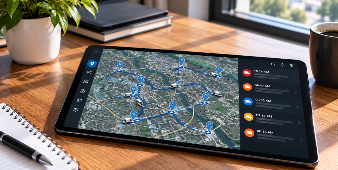
A live map is useful when a dispatcher has a specific question, but staff cannot watch every vehicle continuously. A geofence can flag a reported boundary crossing for later review. It does not physically enforce a zone, prevent a vehicle from moving, or guarantee an immediate warning.
A tracker estimates its position from satellite signals and sends updates according to its configuration and available network. The platform compares reported positions with the boundary and, when a crossing is detected, can log an event and send a notification. A vehicle may cross between updates or enter an area where GPS or cellular service is poor. See GPS.gov’s accuracy guidance for the effect of buildings, blockage, and reflected signals.
What Types of Geofences Can You Set Up?
Geosavi’s public GPS page describes custom geofences and named points of interest. Use the boundary type and alert settings available in your account for the operational question you need to answer; do not assume every shape, rule, or reporting option is included in every plan.
Location Boundaries
Define a boundary around a depot, job site, customer location, or other important area, then choose entry, exit, or both if your configuration supports them. Allow for GPS uncertainty and the site’s actual access roads. An event can approximate arrival or departure, but it does not prove a delivery was completed, a driver checked in, or an exact gate-crossing time.
Custom Points of Interest
A point of interest labels a place in the map or trip history without necessarily creating an active boundary alert. It can make reports easier to read. It does not, by itself, classify a trip as business or personal or establish the substantiation needed for tax reporting; review trip purpose and records under your accounting policy. Geosavi’s GPS tracking page documents POIs and trip reports.
Zone Restrictions
A boundary can be used to flag a reported entry into or exit from an area your fleet wants to review. It does not enforce a traffic restriction or prove a driver violated one. Check applicable local rules separately, verify the location record, and account for position error or delayed reporting before acting on an alert.
What Specific Problems Does Geofencing Solve?
Geofencing can improve visibility in several workflows when the tracker, boundary, alert rules, and follow-up process are configured well. The examples below are investigative prompts, not guaranteed cost savings or proof of misconduct.
Delivery Confirmation Without Manual Check-Ins
A customer-site geofence may give dispatch a useful arrival or departure indication when a position update crosses the boundary. Confirm the visit against the stop record, delivery documentation, or customer acknowledgment before using it for billing or payroll. The event time may differ from the physical arrival because of location error or update intervals.
After-Hours Vehicle Movement
A depot exit alert can prompt a manager to check whether movement after hours was authorized. The alert may arrive later than the physical exit, especially if the device sleeps or loses cellular coverage. If supported driver identification is enabled and the identifier was used correctly, it can add context; it is not conclusive proof of who drove.
Unauthorized Fuel Stops and Route Deviations
A geofence around an approved fuel location can show that a vehicle was reported near that site, not that it bought fuel. Compare trip history with fuel-card transactions, receipts, vehicle data, and dispatch instructions before labeling a stop unauthorized. Route deviations and fuel costs have many causes; geofencing alone does not reduce consumption or prevent fuel theft. Our GPS tracking features guide explains how to use fuel and behavior data as review signals.
Business and Personal Trip Separation
Named business locations can make trip review easier, but visiting a point of interest does not automatically establish the purpose of an entire trip. Where vehicles serve both personal and business use, use driver-provided context and the records required by your tax policy. The IRS vehicle-expense guidance does not make a geofence event a substitute for adequate substantiation.
How Does Geofencing Fit Alongside Live Tracking?
Live tracking answers “where was the last reported position?” Geofencing answers “did a reported position meet an entry or exit rule?” Both depend on the device’s update schedule and connectivity; neither guarantees a current, continuous location trace. Open the trip history after an alert to check the surrounding points, timing, and any gaps.
Geosavi’s GPS platform also describes driver identification, fuel monitoring, reports, and an API. Those can provide additional context when configured and supported for the vehicle, but a geofence event should not be described as automatically connected to every data stream. For a broader evaluation, see our GPS fleet tracking checklist.
What Hardware Does Your Fleet Need for Geofencing to Work?
Choose hardware based on the vehicle or asset, power source, installation, desired reporting frequency, and available coverage. A tracker can store or send positions according to its own settings, while Geosavi’s platform determines what events and notifications your account shows. Do not assume all devices report at the same cadence or that a stored point produces a live alert during a network outage.
Hardwired Trackers for Powered Vehicles
The Teltonika FMM13A is a hardwired LTE Cat M1/GNSS tracker with a small backup battery and configurable inputs. Manufacturer documentation supports geofence scenarios, but how long it operates without vehicle power and which vehicle data it reports depend on installation, battery state, accessories, and configuration. Confirm that the selected tracker is available and supported in your Geosavi plan.
OBD-II Plug-In Trackers
The Teltonika FMM00A is an OBD-II plug-in tracker with LTE Cat M1/GNSS capabilities. Odometer, fuel, and other diagnostic values vary by vehicle and supported protocol; check manufacturer compatibility for the actual models in your fleet. Plug-in installation is convenient, but it does not guarantee every data field or instant geofence reporting.
Asset Trackers for Trailers and Equipment
Battery or solar asset trackers can report trailer and equipment positions without vehicle power. The Teltonika TAT140 is an autonomous asset tracker whose reporting schedule and movement behavior can be configured to balance battery life and timeliness. Manufacturer guidance shows that acquisition and transmission can take minutes, so it should not be described as an instant boundary alarm.
SunTech’s ST4955 series includes solar-assisted variants, but capacity, environmental rating, and reporting behavior differ by exact model. Confirm the exact model, battery, storage, reporting interval, and supported alerts with Geosavi before choosing it for an alert-critical workflow.
How Does GPS Geofencing Compare to Monitoring Without It?
| Monitoring Factor | GPS Geofencing in Our Platform | Without Geofencing |
|---|---|---|
| Alert response time | Alert after a reported crossing is processed; timing varies | May require map or history review unless other alerts are set |
| After-hours coverage | Configured rules can run unattended; device and network must report | Historical positions may still be reviewed later |
| How alerts reach you | Email or mobile notification when configured and delivered | Map or trip history can be checked later |
| Watching multiple locations | Multiple configured boundaries can be evaluated | Requires another alert or later review for a defined crossing |
| Unauthorized movement detection | Reported exit can prompt an authorization check | May be seen in other alerts or location history |
| Driver accountability | Supported driver ID may add a logged-in identifier | Driver identity still depends on the ID process |
| Event documentation | Events may be logged; verify timing and data gaps | Trip history may retain positions without an event rule |
| Fuel cost visibility | Location events can prompt trip and fuel-record review | Other alerts and reports may also surface unusual activity |
What Should You Settle Before Going Live With Geofencing?
Start With High-Risk Locations Before You Expand
Adding a geofence to every stop your fleet visits creates notification volume that makes genuine alerts harder to respond to quickly. Start with the locations where a reported crossing would warrant review: your main depot for overnight monitoring, customer sites where arrival evidence may inform scheduling or billing, and any zone where unauthorized vehicle access carries a measurable cost. Once your team has a response process built around those first boundaries, adding lower-priority locations is a straightforward next step.
Match Each Trigger Type to the Question You Need Answered
Entry and exit rules can indicate when a reported position crosses a boundary. Choose the rule that matches your question, then test it at the site. The timestamp is a device or platform record, not necessarily the exact physical arrival or departure time. Keep the radius large enough for GPS variation without making it too broad to be useful.
Decide Who Receives After-Hours Alerts Before You Turn Them On
An overnight geofence alert is only useful if the right person receives it and knows what to do with it. Before activating weekend or overnight boundaries, identify which person on your team receives those notifications, whether that is an owner, an operations manager, or a designated on-call contact, and document what the expected response looks like. A notification sitting unread in a shared inbox until Monday morning does not help you respond to a vehicle that moved from your yard on Saturday night.
Clarify Your Driver Transparency Policy Before Geofencing Goes Active
Tell drivers what location data is collected, how alerts will be reviewed, who can access it, and how long it is retained under your fleet policy. Privacy, employment, contract, and state requirements may affect monitoring and disclosure; consult the appropriate legal or HR adviser. Do not rely on covert tracking or an alert alone to establish misconduct.
Confirm Your Current Hardware Supports Real-Time Alerts
Confirm the device’s position-reporting interval, sleep behavior, power source, cellular coverage, and account notification settings. A battery asset tracker may wake and report on a schedule rather than at every movement. Test alerts on representative routes and measure actual delay; “real-time” on a product page is not a guaranteed delivery time.
Plan How Each Alert Connects to the Rest of Your Fleet Records
After a geofence event, review the surrounding trip points and any supported driver, fuel, or behavior data. Geosavi documents these platform capabilities, but whether they line up for a particular event depends on hardware, identifiers, vehicle data, and account configuration. Assign a reviewer and a clear next step before turning on many alerts.
Build Trip Classification Structure Into Your Setup From the Start
Set up points of interest for locations that help staff read trip history, then decide how business or personal trip purpose will be verified. POIs can assist categorization; they do not automatically create complete tax records or prove why a vehicle visited a location.
Know Where to Get Help as Your Fleet and Monitoring Needs Change
A depot you add six months from now needs its own boundary. A customer site that becomes a regular stop is a useful point of interest. Your operation will change, and your monitoring setup should reflect those changes without requiring you to figure everything out independently. Contact our support team for platform configuration, alert routing, and hardware compatibility guidance as your fleet changes. Confirm current support hours and service terms with Geosavi.
What Fleet Managers Ask About Geofencing
About How Geofencing Works
Does a geofence alert fire when a vehicle is parked with the engine off?
Possibly, depending on how the tracker is powered and configured. A hardwired tracker may have a backup battery, but its capacity does not guarantee continuous reporting after vehicle power is lost. A battery asset tracker may wake on a schedule or movement event. Test the configured device with ignition off before treating a parked-vehicle geofence as an immediate security alarm.
What happens to geofence data when a device loses cellular coverage?
A device may store positions while cellular service is unavailable and send them later, but local memory, sampling, upload retries, and whether a boundary event is reconstructed vary by model and settings. A delayed history point is not a live notification. Check the exact tracker documentation and Geosavi account behavior for coverage gaps; do not assume every crossing will be recovered.
How quickly does an alert arrive after a vehicle crosses a boundary?
There is no universal delivery time. Delay can include the next GPS fix, the device’s reporting interval, cellular transmission, platform processing, and email or mobile delivery. Asset trackers using power-saving schedules may be much slower than a frequently reporting vehicle unit. Test the installed setup and give urgent security workflows a backup response path.
Can a small GPS positioning error cause a false alert?
Yes. Buildings, bridges, trees, and reflected satellite signals can shift a reported position; GPS.gov explains these sources of error. A very tight boundary can create false entries or exits, while a very broad one can make arrival times less useful. Test radius and alert behavior at the actual site and review nearby points before drawing conclusions.
Does geofencing interact with how our ELD records hours of service?
A geofence event does not create, correct, or certify a driver’s hours-of-service record. ELD duties are governed by FMCSA HOS rules and the carrier’s ELD process. GPS trip history can be useful operational context, but do not substitute it for required ELD records or assume the two data sets have identical timestamps or purposes.
About Hardware, Setup, and Fleet Use
Do trailers and powered vehicles need different tracking hardware?
Usually the power source and reporting need determine the device class. Powered vehicles may use a compatible hardwired or OBD-II tracker; non-powered trailers often need an autonomous battery or solar-assisted unit. The correct choice depends on mounting, coverage, battery life, desired reporting frequency, and vehicle-data compatibility. Confirm the exact Geosavi-supported model before ordering.
Can I set a geofence along a route corridor instead of around a fixed location?
Geosavi’s public GPS page documents custom location geofences and trip history, but does not establish a dynamic route-corridor feature for every account. A series of site geofences can indicate visits to important points, while trip history can support a separate route review. Neither proves that the vehicle followed every part of an assigned route. Ask Geosavi about corridor or route-deviation features for your plan.
How many geofences can I set up across my fleet?
Geosavi’s public GPS page does not state a universal geofence limit. Ask the team what your account and plan support, including any limits on zones, vehicles, alert recipients, and reporting.
Can geofencing help reduce fuel costs?
Potentially, if alerts help staff notice unusual movement and the fleet changes a costly practice. A location event does not prove a fuel purchase, theft, or unnecessary travel. Compare route and stop records with fuel transactions and vehicle data, then measure actual consumption before claiming savings.
Is geofencing a standard part of our GPS tracking plans?
Geosavi’s public GPS tracking page lists geofencing, points of interest, and location-based alerts. It does not establish that every device, account, notification channel, API use, or integration is included at one price. Confirm your plan, hardware, recipients, reporting, and any integration terms with Geosavi.
Does geofencing deliver the same value for a small fleet as for a large one?
Both small and large fleets may find geofence events useful, but the value depends on which locations matter, device coverage, alert volume, and whether someone acts on the information. Start with one or two decisions the fleet can improve and measure whether the alerts are timely and accurate enough to help.
How does driver identification connect to a geofence alert?
Geosavi documents RFID or Dallas ID driver identification that can associate supported trip records with a driver. An alert may show a logged-in identifier when that feature is installed, configured, and used correctly. It does not independently verify who was physically driving at the crossing; check the assignment and other records before attributing conduct.
What is the practical difference between a geofence and a point of interest?
A geofence is a configured virtual boundary that can generate an entry or exit event from reported positions. A point of interest is a named place that helps organize maps and trip reports and may not trigger an alert. Geosavi documents both capabilities; exact controls depend on the account and configuration.
Conclusion
Fleet geofencing is most useful when a boundary answers a clear operational question and the team knows how to review an event. Configure a few high-value locations, test reporting and notification delay, account for GPS error, and compare alerts with trip and business records before acting.
Geosavi’s GPS tracking platform includes geofence, POI, alert, reporting, and integration capabilities, with details that depend on the selected devices and service. To confirm the configuration for your trucks, trailers, and equipment, contact Geosavi or call (800) 261-4361.