Key takeaways:
- GPS/GNSS positioning tells a device where a vehicle is. It does not, by itself, provide dispatching, route optimization, proof of delivery, inventory records, or complete supply-chain visibility.
- Telematics combines location with communications and, when supported, vehicle or sensor data. The available data depends on the device, installation, vehicle, service plan, and software.
- Dispatch, routing, geofencing, ETA, and shipment-visibility tools are separate capabilities. Some platforms combine them, but buyers should verify each feature and integration.
- Location reports are usually near real time. Accuracy and freshness depend on satellite reception, reporting intervals, network availability, and platform processing.
- Operational benefits must be measured. GPS tracking can support better decisions, but it does not guarantee fuel savings, faster deliveries, safer driving, theft recovery, customer satisfaction, productivity, or ROI.
What GPS Tracking Does in Logistics
GPS tracking in logistics gives authorized users time-stamped information about the location and movement of a tracked vehicle or asset. That visibility can support dispatching, arrival monitoring, route review, yard coordination, customer updates, and investigations into unexpected stops or detours.
The location point is only one input. Useful logistics workflows also depend on accurate vehicle assignments, driver and job status, delivery windows, route restrictions, traffic, stop duration, shipment identifiers, and data from other business systems. A map can show where a truck is without showing which order is on it, whether the freight was loaded correctly, how much inventory remains, or whether a delivery was accepted.

For a deeper technical explanation of satellites, receivers, communications, and reporting intervals, see how GPS tracking technology works.
GPS, Telematics, and Logistics Software Are Different
These terms are related but not interchangeable:
- GPS/GNSS positioning: A receiver uses satellite-navigation signals to calculate coordinates, speed, heading, and time. GPS is the U.S. constellation; GNSS is the broader term for compatible satellite-navigation systems.
- Tracking device: Hardware that calculates or receives a position, stores records, and may transmit reports through cellular, satellite, Wi-Fi, or another communications method.
- Telematics: A connected system that transmits vehicle data to a server or cloud platform. Depending on the equipment and integration, it may include GPS location, ignition state, mileage, fault codes, fuel or energy information, and driving events.
- Fleet-management software: A platform for managing vehicles, drivers, maintenance, utilization, documents, costs, or other fleet workflows. Location may be one module or integration.
- Dispatch software: Tools for assigning jobs, loads, vehicles, and drivers and for communicating work status. A location feed can help a dispatcher, but it does not make the assignment decision by itself.
- Route planning and optimization: Software that sequences stops and calculates routes using constraints such as delivery windows, vehicle capacity, driver hours, road restrictions, traffic, service time, and business priorities. GPS supplies current or historical position data; it is not the optimization engine.
- Geofencing: A software rule that compares a reported position with a virtual boundary and may trigger an entry, exit, or dwell alert. It does not physically restrain a vehicle or prevent theft.
- ETA estimation: A prediction based on position plus routing, traffic, stop sequence, service time, and other assumptions. A current location alone is not a reliable ETA.
- Shipment visibility: Tracking a particular load, container, pallet, package, or order through identified milestones. Vehicle location represents shipment location only when the system reliably links the correct shipment to that vehicle or asset.
The U.S. Department of Energy’s federal fleet telematics guide describes a common architecture in which near-real-time GPS and supported vehicle data are transmitted through a cellular network to a cloud platform. It also treats functions such as driver identification as optional, which is a useful reminder that not every system contains every capability.
How Vehicle Location Reaches a Logistics Platform
GPS satellites transmit timing and orbital information. A receiver in the vehicle or asset tracker uses signals from multiple satellites to calculate position. The device then records the position and, if connected, sends a report to a server. The platform associates the report with a vehicle or asset and presents it on a map or through an application programming interface.
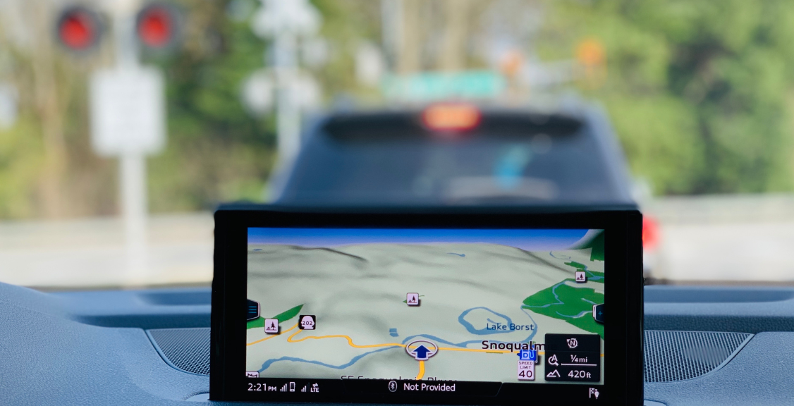
“Real time” generally means near real time. The displayed position can be delayed by the device’s fix and reporting schedule, a cellular or satellite network outage, server processing, or the application’s refresh interval. A store-and-forward device may continue recording positions without coverage and upload them later, but dispatchers do not have live visibility during that gap.
Location is also not guaranteed to one fixed distance. GPS.gov accuracy guidance explains that user accuracy depends on satellite geometry, signal blockage, atmospheric conditions, and receiver design. Buildings, bridges, tunnels, indoor or underground locations, trees, and reflected signals can degrade a fix. Mapping errors can also make correct coordinates appear on the wrong road or address.
How Logistics Teams Use Location Data

Dispatching and Exception Management
A dispatcher can compare reported vehicle positions with job locations and availability data before assigning work. The nearest vehicle is not always the best choice: capacity, equipment type, driver availability, delivery commitments, traffic, and route restrictions may matter more. The dispatch system and dispatcher apply those rules; the GPS feed supplies location evidence.
Location events can also highlight an unexpected stop, missed waypoint, late departure, or route deviation. These should be treated as prompts for review because traffic, approved breaks, customer delays, mapping errors, and stale reports can provide legitimate explanations.
Route Planning and Optimization
Historical trip data can help teams compare planned and actual routes, travel times, dwell time, and repeated delays. Dedicated route-planning software may use those observations along with current traffic and operating constraints to suggest a route or stop sequence.
GPS tracking does not automatically optimize routes. Savings occur only if a suitable routing tool is configured correctly, drivers receive workable instructions, and the organization acts on the results. Mileage, fuel, tolls, labor, on-time performance, and route exceptions should be compared with a defined baseline.
Geofencing and Dwell Monitoring
A geofence can generate an event when a reported position enters, exits, or remains within a defined area. Logistics teams may use these events for depot departures, customer arrivals, terminal activity, unauthorized-area review, or estimated detention and dwell time.
Alert quality depends on boundary design, position accuracy, reporting frequency, and platform rules. A geofence event is not proof that a delivery was completed, freight changed custody, or a driver violated a policy.
ETA and Customer Updates
Vehicle location can improve an ETA model by showing actual progress, but dependable estimates also require the remaining route, traffic, stop sequence, service-time assumptions, delivery window, and fresh reports. An ETA should be presented as an estimate and recalculated when conditions change.
Customer notifications may improve communication when they are timely and accurate. They do not guarantee on-time delivery or customer satisfaction. Teams should measure ETA error, late-notification rate, on-time performance, and support contacts before and after implementation.
Shipment and Proof-of-Delivery Workflows
A vehicle tracker follows the vehicle. To follow a shipment, the platform must associate a load, trailer, container, pallet, or order with the tracked asset and maintain that association through transfers. Trailer or asset trackers, barcode scans, RFID, electronic seals, temperature sensors, carrier status messages, and partner integrations may fill gaps that vehicle GPS cannot.
Electronic proof of delivery is also a separate workflow. A delivery application may capture a signature, photo, barcode, recipient, time, and location, but GPS coordinates alone do not prove condition, quantity, identity, or acceptance.
Driver Events and Vehicle Maintenance
Speed can be derived from GNSS, while harsh braking, acceleration, seat-belt status, fuel use, and diagnostic fault data generally require supported telematics sensors or vehicle interfaces. Automated events are useful for identifying records to review; they are not complete findings about driver performance, safety, or fault.
Likewise, a maintenance platform may use mileage, engine hours, schedules, or supported diagnostic data to prompt service. Basic GPS location does not diagnose mechanical condition, predict every failure, prevent downtime, or extend vehicle life by itself.
GPS Is Not End-to-End Supply-Chain Visibility
End-to-end visibility spans more than road movement. It may require purchase orders, bookings, inventory, warehouse activity, yard status, terminal appointments, container events, carrier milestones, customs information, customer orders, and capacity data across multiple organizations and transportation modes.
The U.S. Department of Transportation’s Freight Logistics Optimization Works guidance explains that information is commonly exchanged among partners to a shipment, yet bilateral track-and-trace communications alone do not provide context across the whole supply chain. Its broader visibility model combines information from multiple participants.
In a business system, the typical roles are:
- GPS or telematics platform: vehicle or asset position, movement, trips, and supported vehicle data;
- transportation management system (TMS): loads, carriers, rates, tenders, routes, milestones, and freight settlement;
- warehouse management system (WMS): receiving, put-away, locations, picking, packing, and shipping within a facility;
- order or enterprise system: customers, purchase and sales orders, item records, billing, and inventory accounting; and
- visibility or integration layer: identifiers and events joined across carriers, facilities, modes, orders, and shipments.
Outdoor vehicle GPS is generally not the right technology for locating individual items inside a warehouse. Warehouse inventory accuracy usually depends on WMS transactions and technologies such as barcodes, RFID, indoor-location systems, or sensors selected for that environment.
Potential Benefits and Their Limits

GPS and telematics data can support operational improvements, but the result depends on fleet type, baseline performance, device coverage, software configuration, integrations, staff adoption, and management follow-through.
- Fuel and mileage: Measure distance, idling, fuel or energy use, route adherence, load, traffic, and season. Location data can reveal opportunities; it does not create savings automatically.
- Delivery time and productivity: Compare stops or jobs per paid hour, travel time, dwell time, failed deliveries, and on-time performance. More completed stops are not automatically better if quality, safety, or service suffers.
- Safety: Review validated events, collisions, exposure, training, and policy compliance. GPS or telematics does not guarantee safer driving or prevent crashes.
- Maintenance: Track scheduled-service completion, breakdowns, downtime, and cost per mile or hour. Benefits depend on supported data and timely action.
- Customer experience: Monitor ETA error, notification timing, delivery exceptions, complaints, and service outcomes. A moving map alone does not establish satisfaction.
- ROI: Compare verified savings or avoided costs with hardware, installation, connectivity, software, integration, training, administration, support, and replacement costs.
A pilot with representative vehicles, routes, drivers, facilities, and coverage areas can expose data gaps before a broad rollout.
Theft Response and Cargo Security
Location tracking may support a theft investigation by providing a last-known or recently reported position. Geofences, unplug alerts, concealed installation, backup power, trailer trackers, and cargo sensors may add useful layers when the chosen system supports them.
Tracking does not prevent theft or guarantee recovery. A device can be removed, shielded, damaged, lose power, fail to obtain a satellite fix, or lose its reporting connection. Alerts also require a monitored response process. Organizations should document escalation steps and work with law enforcement rather than attempting recovery themselves.
Illustrative Logistics Workflows
The following scenarios are examples, not documented case studies or promised outcomes:
- Local distribution: A dispatcher combines fresh vehicle locations with load capacity and delivery windows to evaluate which vehicle should take an added stop.
- Line-haul exception: A platform flags prolonged dwell near a terminal. Staff confirm whether the cause is congestion, an appointment delay, a break, or a data issue before updating the shipment milestone.
- Customer ETA: A delivery system recalculates an ETA using current location, traffic, remaining stops, and service-time assumptions, then sends an update when the prediction crosses a business-defined threshold.
- Asset security: An after-hours geofence alert starts a verification and law-enforcement response process. The alert itself neither proves theft nor guarantees recovery.
- Maintenance planning: Mileage and engine-hour data feed service reminders, while technicians use inspection and diagnostic information to decide what work is required.
For each workflow, define the baseline, responsible person, decision or action, data quality threshold, and KPI before judging the result.
Choosing a GPS Tracking Solution for Logistics

Evaluate the actual workflow rather than a broad feature label. Ask vendors to demonstrate:
- position accuracy under stated conditions and behavior in tunnels, urban canyons, yards, and coverage gaps;
- normal, moving, parked, alarm, and store-and-forward reporting intervals;
- supported cellular or satellite networks, roaming, retention, and outage handling;
- dispatch, route-planning, optimization, geofencing, ETA, proof-of-delivery, and driver-event features separately;
- vehicle, trailer, asset, shipment, order, and driver identifiers and how associations are maintained;
- available TMS, WMS, ERP, order-management, maintenance, and customer-portal integrations;
- supported diagnostic and sensor data for the vehicles and assets in scope;
- data ownership, privacy, access controls, retention, export, and deletion terms; and
- complete costs for hardware, installation, data, licenses, integrations, training, and support.
Related tools may be grouped in one interface, but confirm which capabilities are native, optional, partner-provided, or unavailable. A vehicle-tracking telematics platform and fleet-management software can overlap without being identical.
FAQs About GPS Tracking in Logistics
How accurate is logistics GPS tracking?
There is no universal accuracy radius. Performance varies with satellite geometry, obstruction, reflected signals, atmospheric conditions, antenna placement, receiver design, and mapping quality. Buyers should test representative routes and facilities and review the device’s published conditions.
Does GPS tracking automatically optimize routes?
No. GPS supplies current and historical positions. Route optimization requires software that applies stops, delivery windows, capacity, traffic, restrictions, service times, driver constraints, and business priorities. Some tracking platforms include or integrate with such tools, while others do not.
Can GPS provide complete shipment and inventory visibility?
Not by itself. Vehicle or asset location becomes shipment visibility only when the correct freight is associated with that tracked asset. Warehouse and inventory visibility usually requires WMS, order, scan, RFID, sensor, or partner-event data.
Can GPS tracking guarantee lower costs or faster deliveries?
No. It can reveal opportunities and support routing, dispatch, utilization, and exception workflows. Actual results depend on the baseline, system capabilities, data quality, operating constraints, adoption, and follow-through.
Does GPS tracking guarantee theft recovery?
No. It may provide useful location evidence, but a tracker can be disabled, blocked, damaged, lose power, or lose satellite or network connectivity. Recovery also depends on timely monitoring, response procedures, and law-enforcement coordination.
Build Visibility Around the Decision
GPS tracking in logistics is most useful when location data is connected to a defined decision: dispatching a vehicle, investigating a delay, recalculating an ETA, reviewing a route, confirming utilization, or responding to an alert. It is one layer of logistics visibility, not a substitute for shipment, warehouse, inventory, order, or transportation-management data.
Geosavi can help organizations compare tracking and fleet-data requirements for their routes, vehicles, assets, and integrations. Contact Geosavi to discuss the operating conditions and workflows a logistics tracking solution needs to support.